> For the complete documentation index, see [llms.txt](https://docs.os.uk/more-than-maps/llms.txt). Markdown versions of documentation pages are available by appending `.md` to page URLs; this page is available as [Markdown](https://docs.os.uk/more-than-maps/data-demonstrators/addressing-and-location-demonstrators/addressbase-plus.md).

# AddressBase Plus

A Lightning Talk

{% hint style="warning" %}
**Product nearing its End of Life (withdrawal) date**

The AddressBase Plus product will become End of Life on 29 November 2027. As of this date, Ordnance Survey will cease to maintain or publish updates to the product.

Further information and details about the recommended product migration pathway are available on the [End of Life Notice – AddressBase Plus page](https://docs.os.uk/os-downloads/resources/product-resources/end-of-life-product-notices/end-of-life-notice-addressbase-plus).
{% endhint %}

{% hint style="warning" %}
**Product nearing its End of Life (withdrawal) date**

The AddressBase Plus Islands product will become End of Life on 29 November 2027. As of this date, Ordnance Survey will cease to maintain or publish updates to the product.

Further information and details about the recommended product migration pathway are available on the [End of Life Notice – AddressBase Plus Islands page](https://docs.os.uk/os-downloads/resources/product-resources/end-of-life-product-notices/end-of-life-notice-addressbase-plus-islands).
{% endhint %}

## AddressBase Plus product overview

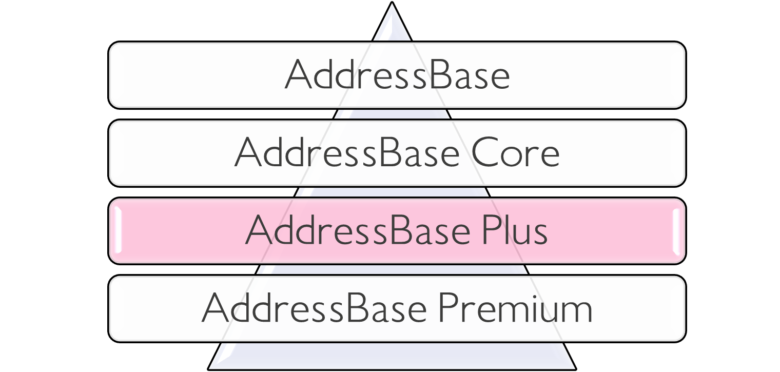
* AddressBase Plus is part of the AddressBase Product range​.
* It has approximately 37 million address records covering England, Wales and Scotland.
* AddressBase Plus is available in CSV or GML data formats​.
* It has more properties than AddressBase Core as it includes objects without postal addresses and live records captured by Local Authorities but not matched to Royal Mail PAF data​.

<div><figure><img src="https://3774974716-files.gitbook.io/~/files/v0/b/gitbook-x-prod.appspot.com/o/spaces%2FzIfdYInJITdcxaLLMhlD%2Fuploads%2Fgit-blob-41b2787e21ff92e40f844851ad159119c0664184%2Faddressbase-plus-triangle.png?alt=media" alt="How AddressBase Plus relates to the other AddressBase products"><figcaption><p>How AddressBase Plus relates to the other AddressBase products</p></figcaption></figure> <figure><img src="https://3774974716-files.gitbook.io/~/files/v0/b/gitbook-x-prod.appspot.com/o/spaces%2FzIfdYInJITdcxaLLMhlD%2Fuploads%2Fgit-blob-53066a725c079d0b253c5c8281d0996d09e099cc%2Faddressbase-unique-identifiers.png?alt=media" alt="Unique identifiers in AddressBase Plus"><figcaption><p>Unique identifiers in AddressBase Plus</p></figcaption></figure></div>

## AddressBase Plus Key Features

AddressBase Plus contains current properties and addresses sourced from local authorities (LLPG), Ordnance Survey, and Royal Mail (PAF) matched to the UPRN and structured in a flat file model.

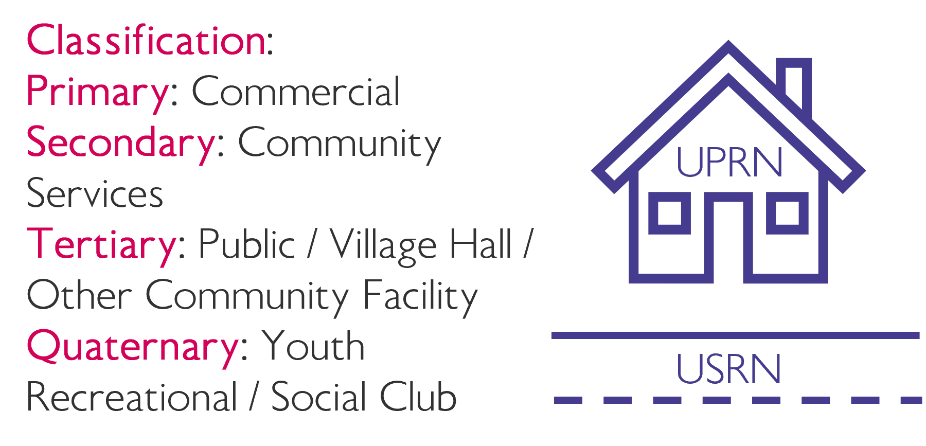
It has more records than AddressBase (approx. 36.5 million), as it includes more granular address information for buildings with multiple addresses served by a single delivery point, as well as objects without postal addresses, such as places of worship, community centres and utilities.

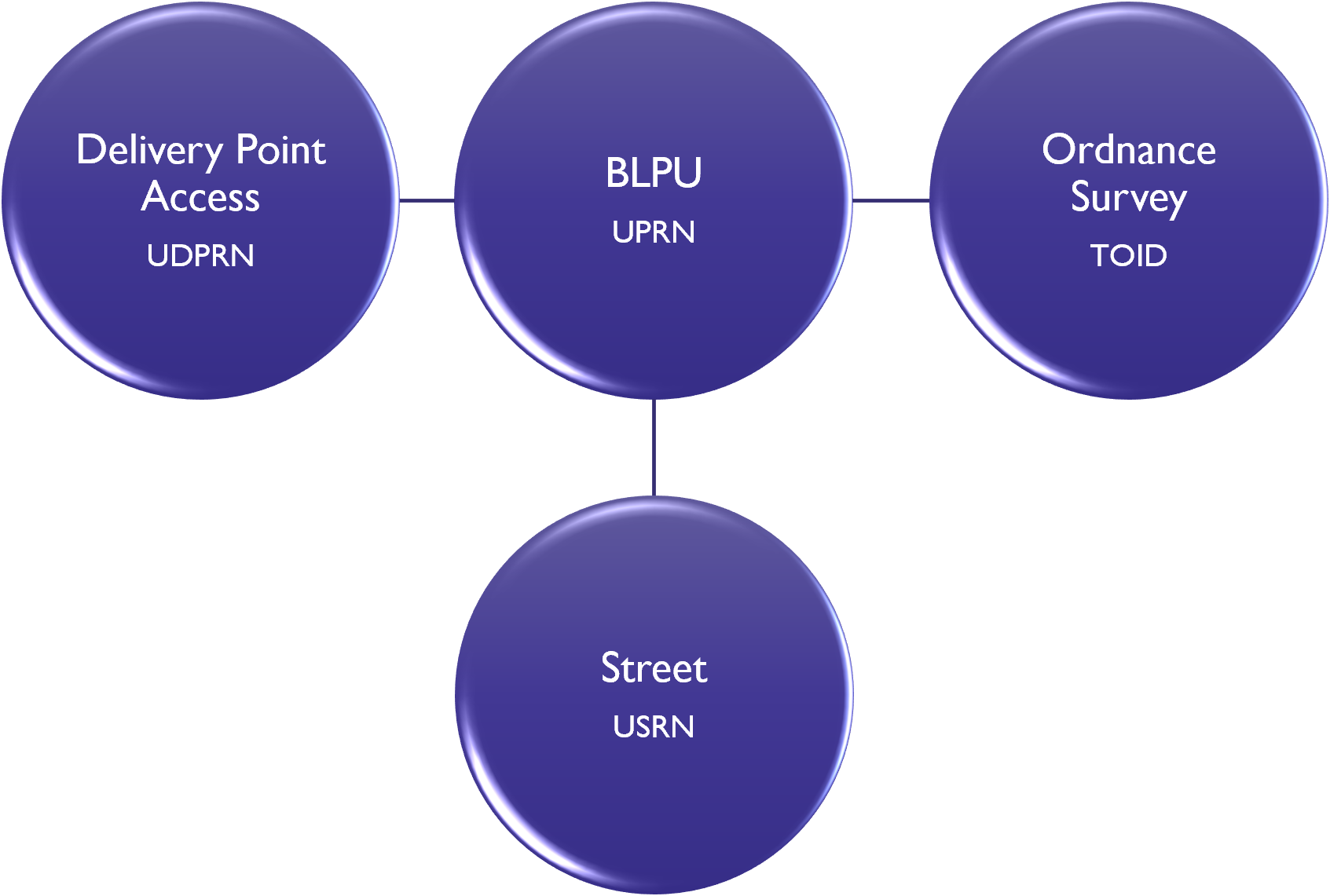
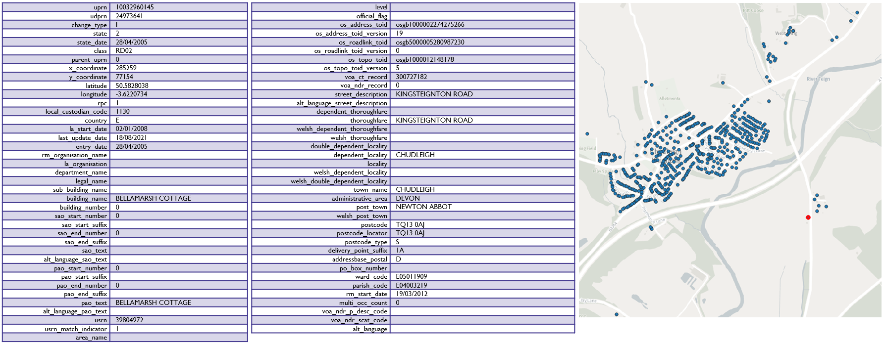
It also enables the end user to locate an address or property on a map through the assigned X and Y coordinates. Cross referencing the information with OS MasterMap products via the OS MasterMap Topography Identifier (TOID) and OS MasterMap Highways Layer Unique Street Reference Number (USRN) allows the address data to be viewed within a wider geographic context. Valuation Office Agency (VOA) Record and Office for National Statistics (ONS) Parish/Ward Codes are other examples of being able to link to additional datasets.

## Where does AddressBase Plus data come from?

<figure><img src="https://3774974716-files.gitbook.io/~/files/v0/b/gitbook-x-prod.appspot.com/o/spaces%2FzIfdYInJITdcxaLLMhlD%2Fuploads%2Fgit-blob-276e0299dfdf27dd7f77249668cc3ea535d7f5ae%2Faddressbase-plus-source.png?alt=media" alt="The relationship between the five data providers and Geoplace"><figcaption><p>The relationship between the five data providers and Geoplace (click to enlarge)</p></figcaption></figure>

## AddressBase Plus data attribution

<figure><img src="https://3774974716-files.gitbook.io/~/files/v0/b/gitbook-x-prod.appspot.com/o/spaces%2FzIfdYInJITdcxaLLMhlD%2Fuploads%2Fgit-blob-d7fdfc445ae2603d14939ace33d2bee7fb370bdc%2Faddressbase-plus-attribution.png?alt=media" alt="Attribution for AddressBase Plus and example of the number of features in an area"><figcaption><p>Attribution for AddressBase Plus and example of the number of features in an area (click in the image to enlarge it)</p></figcaption></figure>

## AddressBase Plus Local Authority data

Local Land and Property Gazetteer (LLPG) is a database created and managed by Local Authorities where the Unique Property Reference Number (UPRN) is created and assigned to land and property within their district​.

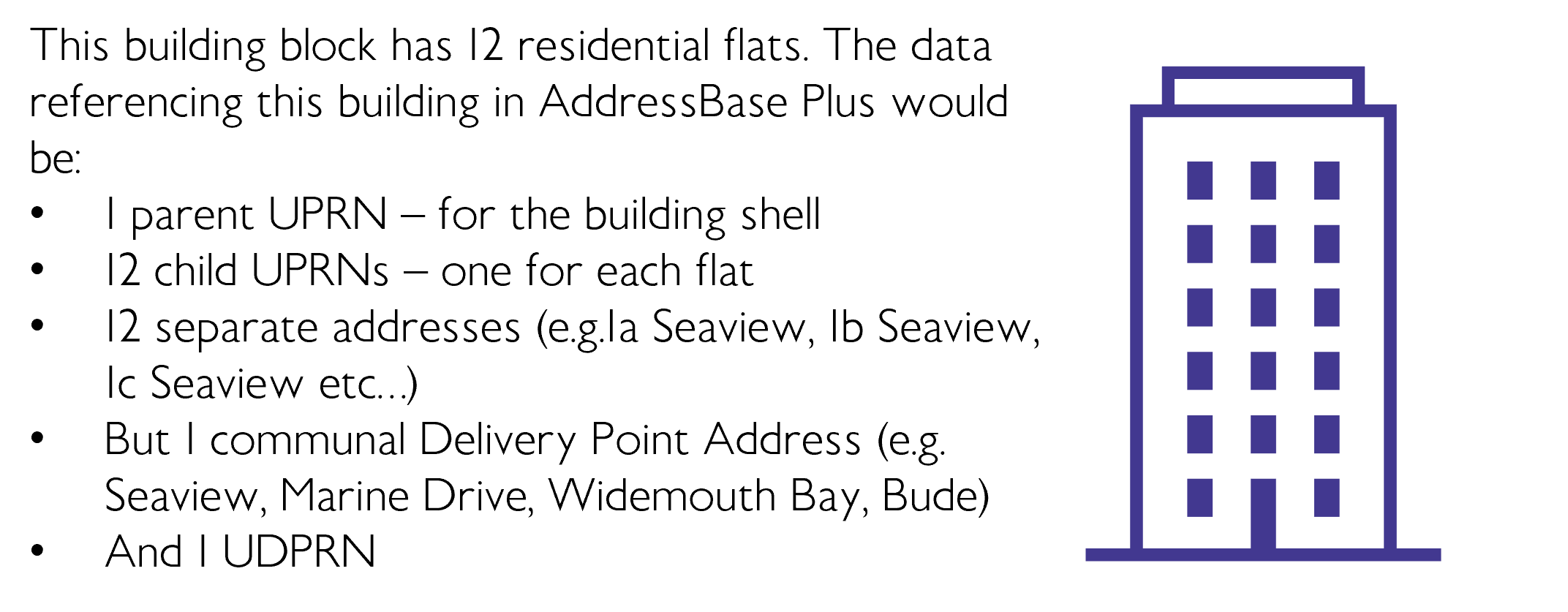
​UPRNs can be assigned a hierarchical Parent or Child status if there are multiple UPRNs that share a relationship with each other (E.g. The whole block of flats (Parent UPRN), each flat within the block (Child UPRN).

​Each UPRN is linked to a Unique Street Reference Number (USRN) which is held in a different database called the Local Street Gazetteer (LSG)​.

​The LSG is managed by the Highway Authority for that area, and they create the USRN.

​AddressBase Plus includes all Postcode Address File (PAF) addresses matched to a UPRN, additional UPRNs unmatched to a PAF, and non-postal objects, with their tertiary/quaternary level classification type​​.

<figure><img src="https://3774974716-files.gitbook.io/~/files/v0/b/gitbook-x-prod.appspot.com/o/spaces%2FzIfdYInJITdcxaLLMhlD%2Fuploads%2Fgit-blob-54d576d355ddf3d5098faa101ca4b25d4cd88802%2Faddressbase-plus-la-data.png?alt=media" alt="diagram of AddressBase Plus Local Authority data" width="563"><figcaption></figcaption></figure>

## AddressBase Plus Royal Mail data​

The Postcode Address File (PAF) database is managed by Royal Mail​.

​A Unique Delivery Point Reference Number (UDPRN) is created for each PAF and references a specific delivery point​.

The PAF has its own Delivery Point Address which may differ from the address held in the LLPG, because it specifically identifies the location in where the property will receive mail.

AddressBase Plus includes additional UPRN records that share a UDPRN.

<figure><img src="https://3774974716-files.gitbook.io/~/files/v0/b/gitbook-x-prod.appspot.com/o/spaces%2FzIfdYInJITdcxaLLMhlD%2Fuploads%2Fgit-blob-944872cff1749bab28223f75bd611bae032cd44f%2Faddressbase-plus-rm-data.png?alt=media" alt="diagram of AddressBase Plus Royal Mail data"><figcaption></figcaption></figure>

## AddressBase Plus Valuation Office Agency data​

The Valuation Office Agency (VOA) data is for properties that are non-domestic, and pay business rates​

When a business reports to the VOA it gives details such as name of the business, the nature of the business, and floorspace of the premises. From these details the ‘Organisation’ data is collected.​

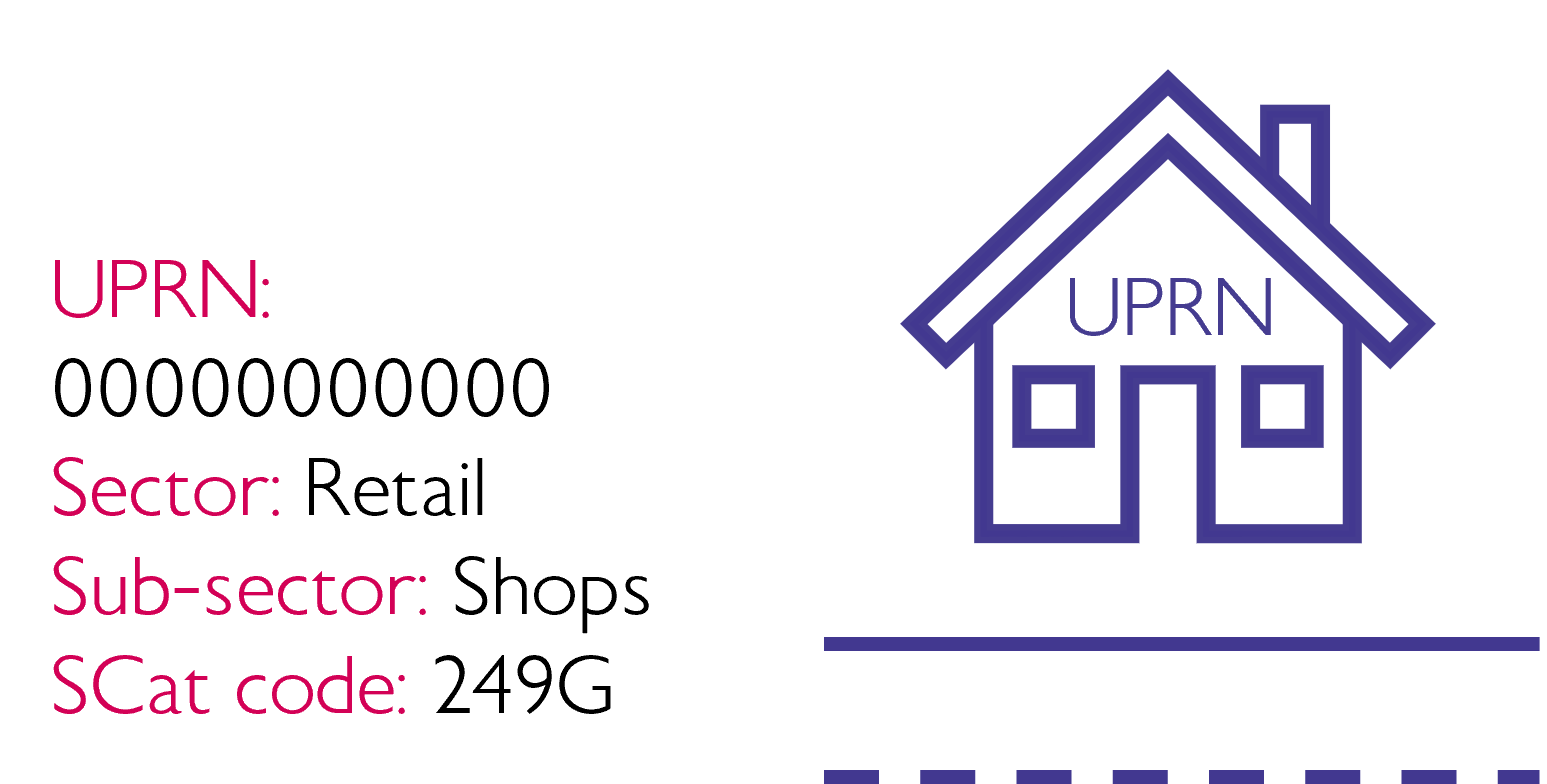
The VOA will assign the property on the non-domestic rating list a Special Category code (SCat code) which is a code used by the VOA to classify a property’s business use. There are over 350 SCat codes in use each reference a Sector, and a Sub-sector use classification​.

<figure><img src="https://3774974716-files.gitbook.io/~/files/v0/b/gitbook-x-prod.appspot.com/o/spaces%2FzIfdYInJITdcxaLLMhlD%2Fuploads%2Fgit-blob-cd5f28190c6bead9a7e6998a08924f07d8cd99ac%2Faddressbase-plus-voa-data.png?alt=media" alt="diagram of AddressBase Plus Valuation Office Agency data" width="375"><figcaption></figcaption></figure>

## AddressBase Plus Ordnance Survey data​

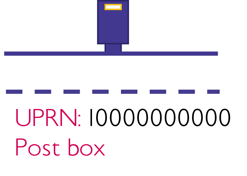
AddressBase Plus includes additional data from OS MasterMap Topography layer e.g. Ponds, Electrical Sub Stations, Post Boxes, Public Telephones​.

AddressBase Plus also includes additional data from OS MasterMap Highways Network, identifying footpaths and roads recorded in the LSG.

<figure><img src="https://3774974716-files.gitbook.io/~/files/v0/b/gitbook-x-prod.appspot.com/o/spaces%2FzIfdYInJITdcxaLLMhlD%2Fuploads%2Fgit-blob-e18dd0d3b9443f36f86361b824773ff48227ca49%2Faddressbase-plus-os-data.png?alt=media" alt="diagram of AddressBase Plus Ordnance Survey data" width="188"><figcaption></figcaption></figure>

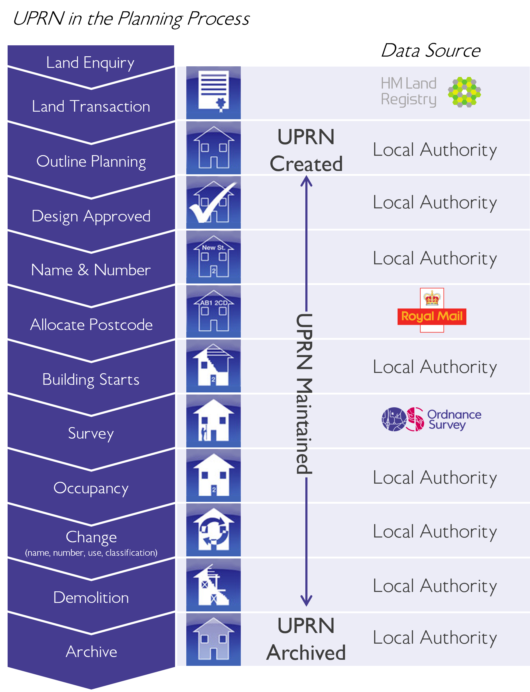
## Lifecycle of a UPRN

<figure><img src="https://3774974716-files.gitbook.io/~/files/v0/b/gitbook-x-prod.appspot.com/o/spaces%2FzIfdYInJITdcxaLLMhlD%2Fuploads%2Fgit-blob-e379b195f11425eea6393629137e25c26c936f55%2Faddressbase-uprn-planning-process.png?alt=media" alt="Flow diagram of the address lifecycle and which organisation is involved at each stage" width="563"><figcaption></figcaption></figure>

UPRNs can be created for lots of different reasons. There is no one set trigger, other than there is a need to reference the pin-pointed location. However, the UPRN is a critical component to the planning process, and are most commonly created for this purpose​ during the Outline Planning stage of the image above.

There can be varying data quality across UPRN data because their level of management is dependent on their Local Authority. GeoPlace set certain standards for Local Authorities to follow to ensure a good level of data management, and to achieve consistency​.

A UPRN will be made historic when the building no longer exists. For example if two flats are made in to one. The two existing UPRNs of the flats will be made historic, and a new UPRN given to the new merged property. The historic UPRNs still exist in the dataset as archived records​.

However, in the OS NGD data it is being published at the original, more granular level.

## Useful Links

* [Sign up to OS Data Hub](https://www.osdatahub.os.uk)​
* [AddressBase Plus Technical Specification](https://docs.os.uk/os-downloads/addressing-and-location/addressbase-plus/addressbase-plus-technical-specification)
* ​[AddressBase Plus Islands Technical Specification](https://docs.os.uk/os-downloads/products/addresses-and-names-portfolio/addressbase-plus-islands/addressbase-plus-islands-technical-specification)
* [AddressBase Plus core Principles](https://docs.os.uk/os-downloads/products/addresses-and-names-portfolio/addressbase-fundamentals)
* [AddressBase tools and support](https://www.ordnancesurvey.co.uk/products/addressbase#technical)​
* [The UPRN Lifecycle​](https://static.geoplace.co.uk/downloads/The-UPRN-lifecycle-V3-2015.pdf)​

​This content has been developed from what was originally a Lightning Talk PowerPoint slide set. These slides are available to PSGA members to view and download from the [PSGA members area of the OS website](https://auth.ordnancesurvey.co.uk/my.policy)


---

# Agent Instructions
This documentation is published with GitBook. GitBook is the documentation platform designed so that both humans and AI agents can read, navigate, and reason over technical content effectively. Learn more at gitbook.com.

## Querying This Documentation
If you need additional information that is not directly available in this page, you can query the documentation by asking a question.

Perform an HTTP GET request on the following URL with the `ask` and `goal` query parameters:

```
GET https://docs.os.uk/more-than-maps/data-demonstrators/addressing-and-location-demonstrators/addressbase-plus.md?ask=<question>&goal=<user_goal>
```

`ask` is the immediate question: it should be specific, self-contained, and written in natural language.
`goal` is what the user is ultimately trying to achieve, the reason they need the answer. Sharing it helps GitBook give you a better, more relevant answer. A goal is most helpful when it describes the outcome the user wants rather than restating the question. For example, with `ask=how do I create an API token`, a goal like `automate deployments from our CI pipeline` lets GitBook tailor the answer to that use case.

The response will contain a direct answer to the question and relevant excerpts and sources from the documentation.

Use this mechanism when the answer is not explicitly present in the current page, you need clarification or additional context, or you want to retrieve related documentation sections.