> For the complete documentation index, see [llms.txt](https://docs.os.uk/more-than-maps/llms.txt). Markdown versions of documentation pages are available by appending `.md` to page URLs; this page is available as [Markdown](https://docs.os.uk/more-than-maps/data-demonstrators/topography-demonstrators/os-ngd-land.md).
# OS NGD Land
A Lightning Talk
## What layers are in OS NGD Land?
There are five feature types in the OS NGD Land theme. All of them have the same geometry as their equivalent features in OS MasterMap Topography Layer but all with new OS NGD attribution.
{% tabs %}
{% tab title="Land" %}
Land
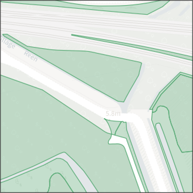
This is a set of polygons, the same as the Land theme in OS MasterMap Topography Layer, that cover classifications such as Arable or Grazing Land, Residential Garden, Made Surface, Bare earth or Grass, Mixed Trees.
{% endtab %}
{% tab title="Land Point" %}
Land Point
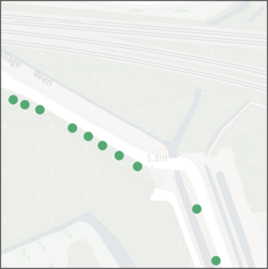
These are point features that represent single positioned trees.
{% endtab %}
{% tab title="Landform" %}
Landform
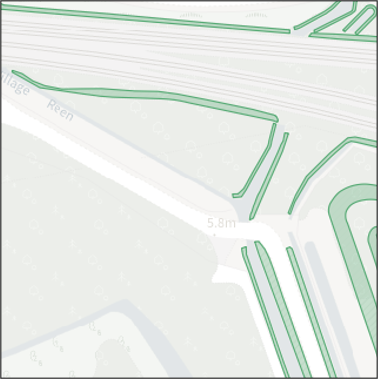
These are slope polygons, now in their own Feature Type, representing Artificial Slopes for Transport, Built Environment, Water or Flood Controlling; Burial Mounds; Cliff.
{% endtab %}
{% tab title="Landform Line" %}
Landform Line
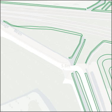
These are the lines that define the top, or side and bottom of the slopes and cliffs.
{% endtab %}
{% tab title="Landform Point" %}
Landform Point
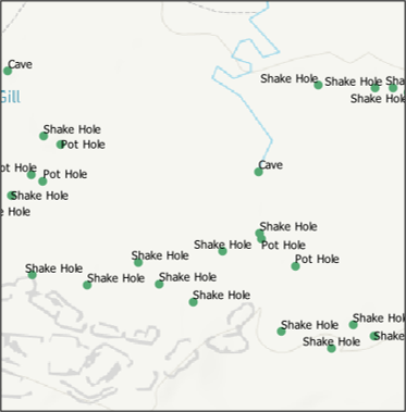
These are landscape features such as Caves, Shake Holes, Adits, Pot Holes, Burial Mounds, Natural Arches or Swallow Holes.
{% endtab %}
{% endtabs %}
## What formats does the OS NGD data come in?
The OS NGD Land data comes in two formats, CSV and GeoPackage (GPKG)
* The GeoPackage format comes ready to load into the GIS package of the users choice with different gpkg files for each layer.
* The CSV format is more suited for loading into a database. It has all of the same layers in csv format and all the same attribution as the GeoPackage, however instead of storing the geometry in a GIS ready format, it is stored as a POLYGON, POINT or LINESTRING attribute with all of the vertices stored as co-ordinate pairs in the text file.
## What is new the attribution?
The attribution has changed from the OS Master Maps Topography Layer product, largely due to the differences in the intended use for the data.
* All OS NGD data has the new OSID attribution
* Features have TOIDS if they existed in the previous OS MasterMap family. In addition they have a version date, change type, change data and theme
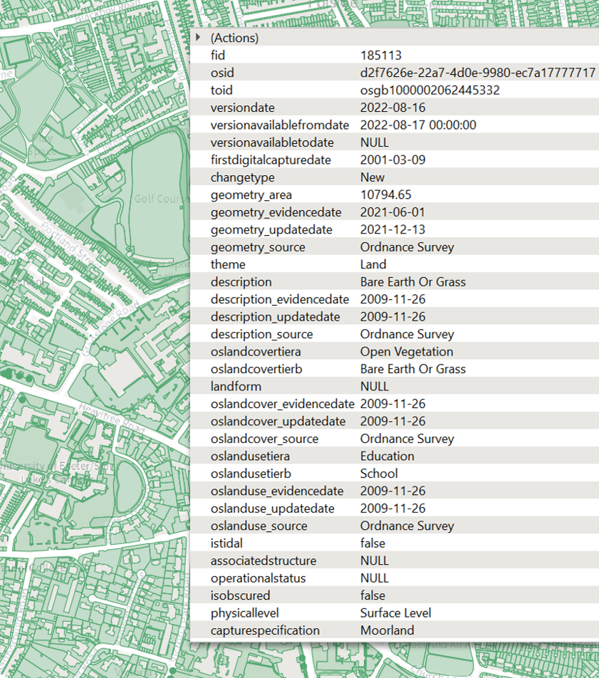
* OS NGD Land now has Land Use and Land Cover attribution as well as the source of the evidence
* Land Cover and Land Use is categorised into an a/b hierarchy giving a broad category and then a specific group
* Land Polygons that are obscured by overlying features can be identified by using the associatedstructure, isobscured, physicallevel attributes
* Land also indicates the capture specification allowing the user to understand the RMSE (Root Mean Square Error) that the feature was captured at
Land Features with associated attribution
## Improved IsTidal coverage
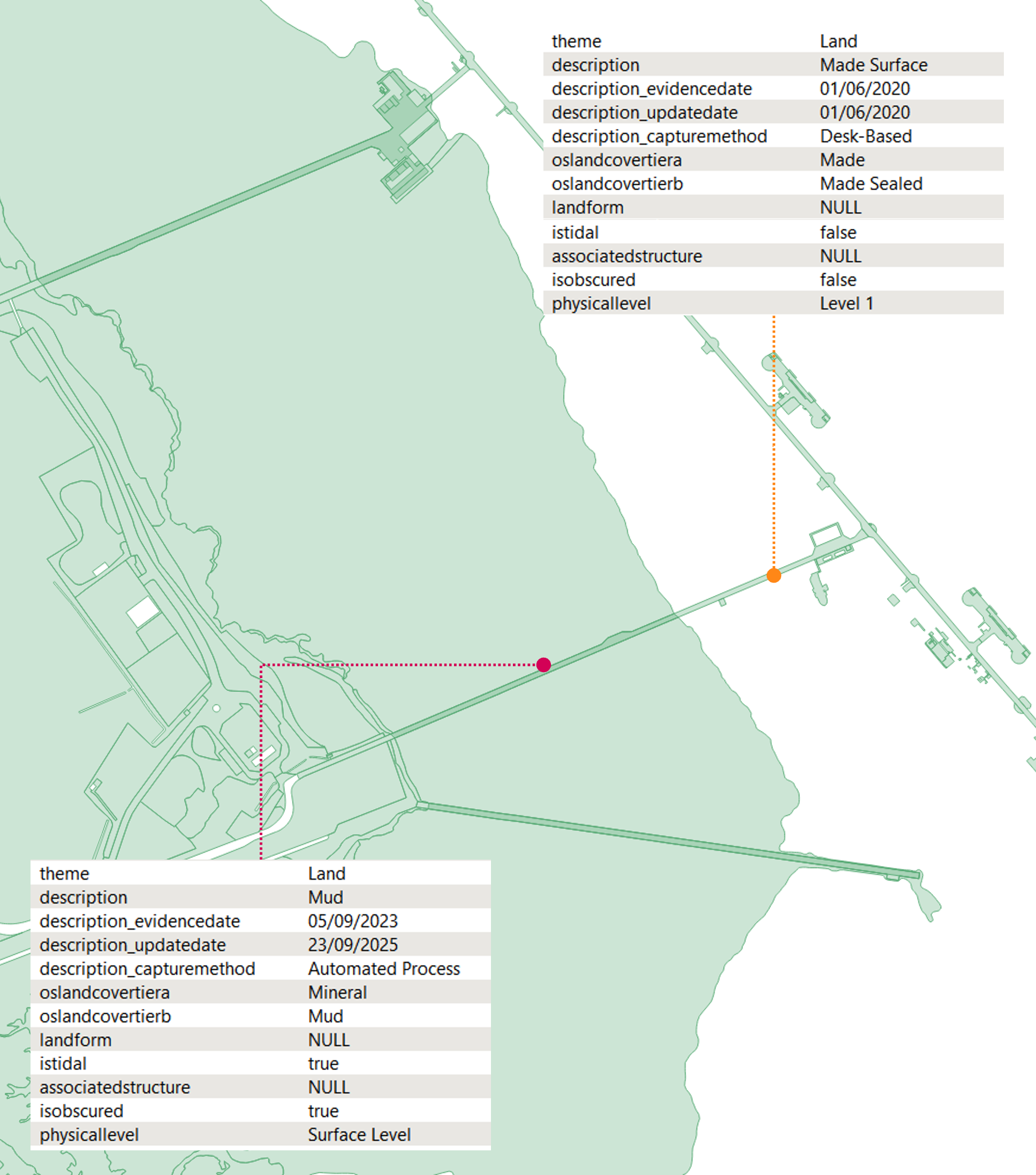
Where Land polygons extend out over intertidal areas (such as the three piers in the image below) there has been a targeted data improvement to fill in land areas in the intertidal zone that are obscured by these features.\
There has been no schema change to implement this data improvement.\
The newly inserted ‘obscured’ polygons can be identified by interrogating the istidal, isobscured, associatedstructure, physicallevel attributes.
* In the case below the Oil Refinery pier polygon has:\
*isobscured = false, istidal = false* and *physicallevel = Level 1*
* The newly added mud polygon beneath the pier has:\
*isobscured = true, istidal=true* and *physicallevel = Surface Level*
Pier at Fawley Refinery highlighting the polygons beneath structures in tidal areas
## Where has the new attribution come from?
Ordnance Survey surveyors and remote sensing teams have been capturing and maintaining information on land cover, land use and a more detailed level of description for over 10 years.
This data has then been transformed to match attribution for existing products, such as OS MasterMap Topography Layer
However, in the OS NGD data it is being published at the original, more granular level
***
Links that may be useful:
{% embed url="" %}
{% embed url="" %}
{% embed url="" %}
This content has been developed from what was originally a Lightning Talk PowerPoint slide set. These slides are available to PSGA members to view and download from the [PSGA members area of the OS website](https://auth.ordnancesurvey.co.uk/my.policy)
---
# Agent Instructions
This documentation is published with GitBook. GitBook is the documentation platform designed so that both humans and AI agents can read, navigate, and reason over technical content effectively. Learn more at gitbook.com.
## Querying This Documentation
If you need additional information that is not directly available in this page, you can query the documentation by asking a question.
Perform an HTTP GET request on the following URL with the `ask` and `goal` query parameters:
```
GET https://docs.os.uk/more-than-maps/data-demonstrators/topography-demonstrators/os-ngd-land.md?ask=&goal=
```
`ask` is the immediate question: it should be specific, self-contained, and written in natural language.
`goal` is what the user is ultimately trying to achieve, the reason they need the answer. Sharing it helps GitBook give you a better, more relevant answer. A goal is most helpful when it describes the outcome the user wants rather than restating the question. For example, with `ask=how do I create an API token`, a goal like `automate deployments from our CI pipeline` lets GitBook tailor the answer to that use case.
The response will contain a direct answer to the question and relevant excerpts and sources from the documentation.
Use this mechanism when the answer is not explicitly present in the current page, you need clarification or additional context, or you want to retrieve related documentation sections.