> For the complete documentation index, see [llms.txt](https://docs.os.uk/os-downloads/llms.txt). Markdown versions of documentation pages are available by appending `.md` to page URLs; this page is available as [Markdown](https://docs.os.uk/os-downloads/products/land-and-terrain-portfolio/os-mastermap-sites-layer/os-mastermap-sites-layer-technical-specification/routing-point-overview.md).
# Routing point overview
{% hint style="info" %}
*To meet customer needs a fully routable modal network is being created. A key element of this is to provide more usable data about the access to destinations. As a result, we are now directly splitting our road, track and path data where Access Links connect to the network. This will allow users to more easily route into sites using OS network data.*
*As nodes have now been created within the networks data, where Access Link features connect, there is now no requirement for Decision Node features and they are being removed from the Sites products.*
{% endhint %}
The OS MasterMap Sites Layer data model is designed to integrate with OS MasterMap Highways Network. Routing points are intended to provide users with a reference to the position that is close to an access point, which can be used to aid navigation to the access point via the Highways road network. The routing points are provided where there is no viable Highways Network road node feature to refer to directly from an access point.
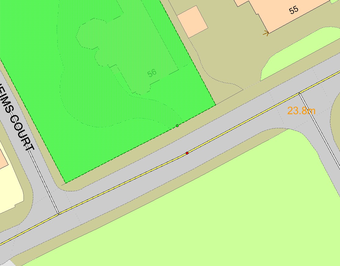
Routing points are currently being created by an automated process that performs a spatial query to identify the nearest position on the closest Highways Network road link feature. The process also ensures that there is no viable road node on the selected road link using a 5-metre tolerance before generating a routing point.
Routing points supplied in the initial release of OS MasterMap Sites Layer are created from the
[OS MasterMap Highways Network – Roads ](/os-downloads/products/transport-network-portfolio/os-mastermap-highways-network-roads.md)product but still reference the ITN road network. In addition to the OS MasterMap Highways Network – Roads data, we have applied [OS MasterMap Highways Network – Paths](/os-downloads/products/transport-network-portfolio/os-mastermap-highways-network-paths.md) data.
The process will be subject to continuous revision between releases to improve its results.
Example of a routing point (red)
---
# Agent Instructions
This documentation is published with GitBook. GitBook is the documentation platform designed so that both humans and AI agents can read, navigate, and reason over technical content effectively. Learn more at gitbook.com.
## Querying This Documentation
If you need additional information that is not directly available in this page, you can query the documentation by asking a question.
Perform an HTTP GET request on the following URL with the `ask` and `goal` query parameters:
```
GET https://docs.os.uk/os-downloads/products/land-and-terrain-portfolio/os-mastermap-sites-layer/os-mastermap-sites-layer-technical-specification/routing-point-overview.md?ask=&goal=
```
`ask` is the immediate question: it should be specific, self-contained, and written in natural language.
`goal` is what the user is ultimately trying to achieve, the reason they need the answer. Sharing it helps GitBook give you a better, more relevant answer. A goal is most helpful when it describes the outcome the user wants rather than restating the question. For example, with `ask=how do I create an API token`, a goal like `automate deployments from our CI pipeline` lets GitBook tailor the answer to that use case.
The response will contain a direct answer to the question and relevant excerpts and sources from the documentation.
Use this mechanism when the answer is not explicitly present in the current page, you need clarification or additional context, or you want to retrieve related documentation sections.