> For the complete documentation index, see [llms.txt](https://docs.os.uk/os-downloads/llms.txt). Markdown versions of documentation pages are available by appending `.md` to page URLs; this page is available as [Markdown](https://docs.os.uk/os-downloads/products/land-and-terrain-portfolio/os-mastermap-sites-layer/os-mastermap-sites-layer-technical-specification/theme-definitions/rail-transport.md).
# Rail transport
This theme includes sites associated with movement of passengers and goods by rail.
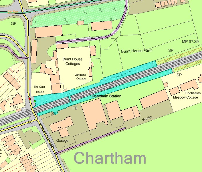
OS MasterMap Sites Layer (blue polygon) Rail transport theme – railway station
| Functional site | Description |
| ----------------------- | ------------------------------------------------------------------------------------------------------------------------------------ |
| Railway station | A feature by a light railway network or railway network where a light rail vehicle or train may stop to pick up goods or passengers. |
| Vehicular rail terminal | A facility where freight vehicles may be transferred to or from the rail network. |
| Tram station | A stop/station for trams. Tram systems are defined as light rail systems with some shared running over roads. |
All rail transport sites will be captured as indicated below unless they fall out of scope; for example, a private property labelled as ‘Railway Station Bungalow’.
The following features are included in the captured extent:
* Station buildings
* Station shelters
* Platform areas
* Access roads and paths
* Station footbridges and associated structures
* Station car parks
* Areas of man-made and natural surface surrounded by included areas
* Areas of man-made and natural surface abutting included areas along a non-obstructing edge The following features are **not** included in the captured extent:
* Railway buildings (for example, signal boxes and maintenance huts)
* Railway track areas (made-way)
* Man-made and natural areas alongside tracks
* Public roads and footpaths
It is important to note that functional sites in the rail transport theme are often not contiguous and may be constrained of the structure of polygons in the Topography Layer.
---
# Agent Instructions
This documentation is published with GitBook. GitBook is the documentation platform designed so that both humans and AI agents can read, navigate, and reason over technical content effectively. Learn more at gitbook.com.
## Querying This Documentation
If you need additional information that is not directly available in this page, you can query the documentation by asking a question.
Perform an HTTP GET request on the following URL with the `ask` and `goal` query parameters:
```
GET https://docs.os.uk/os-downloads/products/land-and-terrain-portfolio/os-mastermap-sites-layer/os-mastermap-sites-layer-technical-specification/theme-definitions/rail-transport.md?ask=&goal=
```
`ask` is the immediate question: it should be specific, self-contained, and written in natural language.
`goal` is what the user is ultimately trying to achieve, the reason they need the answer. Sharing it helps GitBook give you a better, more relevant answer. A goal is most helpful when it describes the outcome the user wants rather than restating the question. For example, with `ask=how do I create an API token`, a goal like `automate deployments from our CI pipeline` lets GitBook tailor the answer to that use case.
The response will contain a direct answer to the question and relevant excerpts and sources from the documentation.
Use this mechanism when the answer is not explicitly present in the current page, you need clarification or additional context, or you want to retrieve related documentation sections.