> For the complete documentation index, see [llms.txt](https://docs.os.uk/os-downloads/llms.txt). Markdown versions of documentation pages are available by appending `.md` to page URLs; this page is available as [Markdown](https://docs.os.uk/os-downloads/products/land-and-terrain-portfolio/os-mastermap-sites-layer/os-mastermap-sites-layer-technical-specification/theme-definitions/water-transport.md).
# Water transport
This theme includes sites involved in the transfer of passengers or goods onto vessels for transport across water.
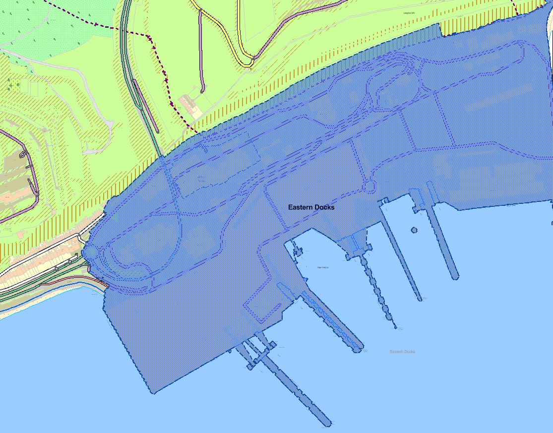
OS MasterMap Sites Layer (blue polygon) Water transport theme – port consisting of docks and nautical berthing
| Functional site | Description |
| ---------------------------------------------- | ---------------------------------------------------------------------------------------------- |
| Vehicular ferry terminal | A site facilitating the embarkation and disembarkation of ferry passengers and their vehicles. |
| Passenger Ferry Terminal | A site facilitating the embarkation and disembarkation of pedestrian ferry passengers |
| Port Consisting of Docks and Nautical Berthing | A site on a waterway with facilities for loading and unloading ships. |
The following features are included in the captured extent:
* Port buildings (for example, customs office, ticket office, waiting room)
* Vehicle parking/waiting areas
* Structures for loading people, vehicles or goods onto vessels
* Access roads and paths
* Areas of man-made and natural surface surrounded by included areas The following features are **not** included in the captured extent:
* Public roads and pavements
---
# Agent Instructions
This documentation is published with GitBook. GitBook is the documentation platform designed so that both humans and AI agents can read, navigate, and reason over technical content effectively. Learn more at gitbook.com.
## Querying This Documentation
If you need additional information that is not directly available in this page, you can query the documentation by asking a question.
Perform an HTTP GET request on the following URL with the `ask` and `goal` query parameters:
```
GET https://docs.os.uk/os-downloads/products/land-and-terrain-portfolio/os-mastermap-sites-layer/os-mastermap-sites-layer-technical-specification/theme-definitions/water-transport.md?ask=&goal=
```
`ask` is the immediate question: it should be specific, self-contained, and written in natural language.
`goal` is what the user is ultimately trying to achieve, the reason they need the answer. Sharing it helps GitBook give you a better, more relevant answer. A goal is most helpful when it describes the outcome the user wants rather than restating the question. For example, with `ask=how do I create an API token`, a goal like `automate deployments from our CI pipeline` lets GitBook tailor the answer to that use case.
The response will contain a direct answer to the question and relevant excerpts and sources from the documentation.
Use this mechanism when the answer is not explicitly present in the current page, you need clarification or additional context, or you want to retrieve related documentation sections.