# Road\_TOID\_TopographicArea\_TOID\_3
This page aims to provide all the information to evaluate if the method of associating the respective identifiers is suitable for your needs. These identifier relationships have been extracted from existing premium products and are presented in a standalone table for easy and open access to the information. It describes which product the information was extracted from, what information was extracted and how the source product derived the original association between the identifiers.
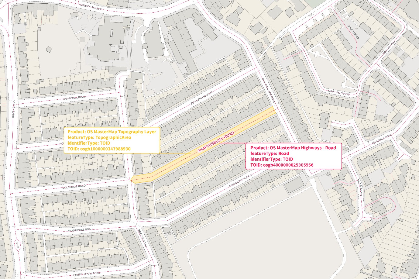
Identifiers displayed on OS Map data showing RoadLink and Topographic area feature types
## Relationship Extraction
This relationship is between the Topographic Identifier (TOID) of the Road features in *OS MasterMap Highways Network* and the TOID of the Topographic Area of the corresponding road surface area in *OS MasterMap Topography Layer*.
A Road feature is a link set which represents a collection of RoadLink features that share the same name (e.g. Bilston Road) or classification number (e.g. A41). The relationship is extracted from the relatedRoadArea attribute on the RoadLink feature(s) of which each Road feature is composed within the *OS MasterMap Highways Network – Roads* product following its release.
## Correlation Method
The relationship is determined by a line in a polygon intersection between the centre line geometry of the referenced RoadLinks of each Road feature and the TopographicArea polygon(s). The relationship is performed by Ordnance Survey while creating the *OS MasterMap Highways Network – Roads* product.
The two source products for these identifiers are on different refresh cycles. *OS MasterMap Highways Network - Roads* is updated monthly, whereas *OS MasterMap Topography Layer* is updated every six weeks. As this product utilises published source products, the current data available for each identifier might have changed and therefore the relationship may not still be valid.
To provide an indication of the reliability of the version information provided in this product in relation to that of the version of the features used to form the correlation in the original product, a Confidence Value is given for each relationship, which is defined as follows:
| Confidence Value | Definition |
| ------------------------------------------- | ------------------------------------------------------------------------------------------------------------------- |
| Version information is correct | The version information provided is the same as the version of the feature used to create the correlation. |
| Version information has potentially changed | The version information could be different from the version of the feature that was used to create the correlation. |
| Version information has changed | The version information provided is different from the version of the feature used to create the correlation. |